

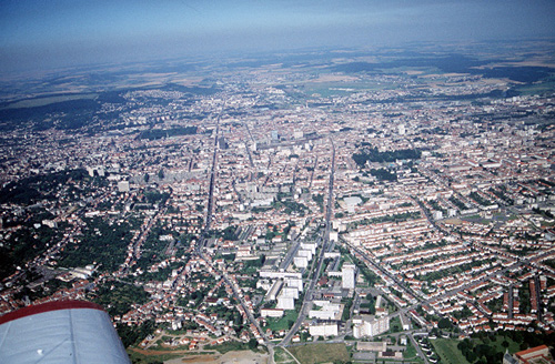
Nancy (54)
| Référence | 90-0444 |
|---|---|
| Pays | France |
| Div. admin. 1 | Lorraine |
| Div. admin. 2 | 54 Meurthe-et-Moselle |
| Commune | Nancy |
| Unité géographique | Côtes de Moselle, Vallée de la Meurthe |
| Référence de la carte | Nancy 3415 ouest, Nancy. Toul. Forêt de Haye 3315 est | Coordonnées géographiques | 48° 40' 49" N, 6° 9' 12" E |
| Domaines | Périurbanisation - Paysage urbain |
| Mots-clés | banlieue, périurbain, skyline, structure urbaine |
| Commentaires | Orientation : O. Crédits photographiques : A. Humbert. |