

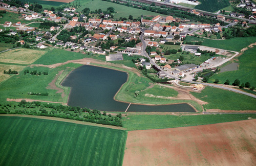
Bénestroff (57)
| Référence | 98-0810 |
|---|---|
| Pays | France |
| Div. admin. 1 | Lorraine |
| Div. admin. 2 | 57 Moselle |
| Commune | Bénestroff |
| Unité géographique | Pays des Etangs | Coordonnées géographiques | 48° 54' 19" N, 6° 45' 26" E |
| Domaines | Paysage rural - Hydrologie - Communications |
| Mots-clés | céréaliculture, étang, morphologie villageoise, voie ferrée |
| Commentaires | Le 17 mai 1998 à 11 00. Orientation : N. Crédits photographiques : R. Berton - A. Humbert. étang JP |