

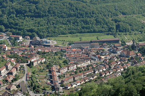
Longwy (54)
| Référence | 06-0123 |
|---|---|
| Pays | France |
| Div. admin. 1 | Lorraine |
| Div. admin. 2 | 54 Meurthe-et-Moselle |
| Commune | Longwy |
| Unité géographique | Vallée de la Chiers | Coordonnées géographiques | 49° 31' 49" N, 5° 46' 40" E |
| Domaines | Paysage industriel - Périurbanisation |
| Mots-clés | cité ouvrière, lotissement pavillonnaire |
| Commentaires | Le 11 juin 2006 à 15h30. Crédits photographiques : A. Humbert. |