

Fuengirola
| Référence | SP 11-0369 |
|---|---|
| Pays | Espagne |
| Div. admin. 1 | Andalucía |
| Div. admin. 2 | Málaga |
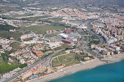
| Commune | Fuengirola - Playa Del Castillo |
| Unité géographique | Costa del Sol | Coordonnées géographiques | 36° 31' 33" N, 4° 37' 39" W |
| Domaines | Communications - Littoral |
| Mots-clés | autoroute, hôtel, parc, plage, urbanisation littorale, zone commerciale |
| Commentaires | Le 04 mai 2011 à 11 h 30. Crédits photographiques : A. Humbert - H. Popp. |